Historic Reactor B TourAfter visiting with my grandfather again in the morning at Dry Falls SP, we packed up camp and hit the road for Richland, WA and the Manhattan Project National Historic Park. The Hanford Site is one of three parts of the Manhattan Project NHP, along with Oak Ridge, TN and Los Alamos, NM. The park consists of a welcome center with a few small exhibits on the outskirts of Richland and portions of site itself. You can book one of two tours offered by the park online in advance for free. They offer tours of historic Reactor B and of the former town of Hanford that was evacuated when the military arrived in the area. I had tried to tour the reactor years ago with a friend but life got in the way, so I was excited to spend the day at the reactor. We arrived at the welcome center about 30 minutes before our scheduled tour. They have a small exhibit area at the welcome center but overall there is not much to see. The Manhattan Project NHP has the traditional NPS stamp but they also have an awesome wedge stamp that combines with stamps at Oak Ridge and Los Alamos to make a circle. When your tour time starts, everyone gathers in a room and watches a video on the history of the Manhattan Project. The military needed a site to build the world's first full-scale plutonium production reactor. Hanford was chosen for its isolation and access to the Columbia River for water and power. The tour is at the reactor itself, which is about a 45 minute bus ride from the welcome center. With the two bus rides, the tour will take the majority of your day and you will want to bring snacks for the bus. We set out out for Reactor B around noon for our tour. The projected high temperature for the area was 117 degrees and we were boarding a bus to head off into the scablands. The majority of the Hanford site is under the purview of the Department of Energy, with the National Parks Service helping run the historic areas. The Hanford Site still has some active areas and there is a tremendous environmental clean-up taking place in some areas. You ride in the bus around the outskirts of the site and can see the government presence in a couple of entry ways. The tour bus pulls up to a nondescript gate in the middle of nowhere and the tour guide gets out and opens it to let the bus...pretty great to see after driving by the military entrance gates. The tour starts with a long and detailed presentation on the science and history behind Reactor B. If you do not enjoy science, you may fall asleep during this portion of the day. I now can fully describe the reaction process and design of the reactor in great detail. After this presentation, they lead you on a brief tour of the reactor and give you about an hour to explore on your own and take pictures. The temperature in the parking lot outside the reactor registered at 117 degrees, so we were a pretty subdued group after about 30 minutes of wandering around. You then take the bus back to the welcome center and conclude your tour. There are a few breweries and restaurants in the business park that houses the welcome center so you can grab a beer after a long day of history and heat. If you are a WWII history buff or into science, you will love this tour. I was impressed with the knowledge of the presenters and the amount of information I have retained from my visit. I would love to visit Oak Ridge and Los Alamos to round out my Manhattan Project stamp circle. New Units Visited: 1
Manhattan Project NHP Total Affiliated Areas This Year: 21 Total Units: 30
0 Comments
Lake Roosevelt National Recreation AreaWith the summer's end fast approaching, my wife and I decided to take one last adventure for the summer. My grandfather served as a volunteer campsite host at Dry Falls State Park and we wanted to visit him. I took the opportunity to plan one last passport stamp collecting trip with the objective of spending a night at Dry Falls and visiting my grandpa. There was terrible air quality in the northwest during this week due to forest fires in Canada and brush fires all over Washington. On top of that, the temperature was approaching 110 degrees in the area. The heat made spending a day in the air conditioning of the car and visiting different sites along Lake Roosevelt fairly appealing. Lake Roosevelt was formed by flooding from the Columbia River after the Grand Coulee Dam was built in 1941. Lake Roosevelt offers a number of recreational opportunities and features some interesting historic sites as well. We were able to visit all of the NRA's stamp locations except Kettle Falls, which is a couple hours north of the other stops. Fort SpokaneWe started the day at Fort Spokane just south of the river. Fort Spokane was a Army frontier outpost at the convergence of the Columbia and Spokane Rivers about 50 miles from Spokane. The fort had about 50 buildings at its high point and served as a military presence for about 20 years in the later 1800s. During the Spanish-American War, the military aspect of the fort was moved elsewhere and the facility was turned over to the Colville Indian Agency to serve as an Indian school for a number of years. The fort today features just a few of the original buildings and has a historic walking tour that allows you get a feel for the size and of the site while teaching you the fort's history. The museum had a number of interesting exhibits but the jail cells were particularly powerful. They had two small cells that each featured an audio recording based off the writings of Indian children that were forced to spend time in the cells for breaking various rules at the school. Indian schools are a dark stop in American history and Fort Spokane does a great job bringing this difficult subject to light. We didn't do much exploring due to the high heat and the aggressiveness of the wasps in the park. Grand Coulee DamAfter leaving Fort Spokane, we spent a couple of hours driving through eastern Washington's endless farm country. We made our way along US 2 toward Grand Coulee. We made a quick stop at Lake Roosevelt NRA's Spring Canyon area. Spring Canyon features a little campground, a picnic area, and a public beach. The ranger station here is no longer staffed permanently due to budget constraints so I was not able to get the stamp for this location. From here, we made our way to the Grand Coulee Dam. The Grand Coulee Dam blocks the Columbia River creating 150 miles of Lake Roosevelt. The dam creates power for the Columbia Basin and irrigates 600,000 acres of farmland. I had been to Grand Coulee before, but the dam is a powerful site to behold every time you visit. I had never gone in the visitor center previously and was interested to read the different exhibits and see the natural history of the area. Grand Coulee is also a part of the Ice Age Floods NGT since the coulees of central Washington were formed by the many great floods during the ice ages. After the dam, we visited the Lake Roosevelt NRA offices in town for their stamps. We did not want to take the time to go on a tour of the dam on this visit. They do a light show in the dam at night and we want to come another time to see the show and go on a tour. Steamboat Rock State ParkAn unexpected but enjoyable detour on our drive from Grand Coulee to Dry Falls was Steamboat Rock State Park. The drive south from Grand Coulee is a beautiful route along the water surrounded by cliffs carved over the eons by the river. As we made our way, we saw a sign for Steamboat Rock and made a quick pit stop. We really only drove through the park but were impressed by the views and recreation options. They had hiking trails, a campground, and water rentals. We would love to camp out here some time and head up to the dam for the night time laser light show. Dry Falls/Sun Lakes State ParkOur final destination for the day was Dry Falls/Sun Lakes State Park. I guess the name of the park has changed a few times and they have settled on having two names for the place. The Dry Falls were truly one of the most surprising and impressive things I have ever seen. I had never heard of Dry Falls before this summer and really didn't look up any pictures before our arrival. I had read up on the park but somehow hadn't seen any images. As your drive up to the visitor center, you can see nothing but rolling farmland in any direction. It isn't until you walk right up to the fence that you can see the Dry Falls. Dry Falls is a truly massive hole in the ground, something like a miniature Grand Canyon. The Ice Age Floods created water falls 3.5 miles wide, five times wider than Niagara Falls. Scientists think that it had a flow ten times greater than all the current rivers in the world combined! I was really quite blown away by the view and very pleased to learn that the state park was at the bottom of Dry Falls and that we were about to spend the night at the bottom. Dry Falls is part of the Ice Age Floods NGT so we picked up our stamps and then headed down to visit with my grandfather for the night and cool off in the lake. We camped out here and did a little paddle-boarding before heading off the next day.  New Units Visited: 1
Lake Roosevelt NRA Total Affiliated Areas This Year: 20 Total Units: 29 Ice Age Floods National Geologic TrailMy biggest goals within the National Parks Passport program in the short term are to visit all of the NPS units in Washington state (hopefully in the summer of 2019) and to complete the entire Ice Age Floods National Geologic Trail. This trail is comprised of a number of sites in the northwest centered around the Missoula Floods after the last ice age. Glacial dams in Idaho and Montana gave out and released massive flooding across Washington and Idaho, emptying large inland seas across the continent. These floods have always interested me since they explain many unique geologic features in Washington state. My first stop on this trail was Turnbull National Wildlife Refuge, only a 45 minute drive from my house and the only stamping location that close to my new home in Spokane. I had recently accepted a teaching position for a local school district and needed to drop off some paperwork at our offices, and decided to make a day out of it and visit nearby Turnbull. The Channeled Scablands of Turnbull were created during the great floods of the last ice age. The area is unique for its mixture of basalt outcroppings, flooded channels, and pine forests. The wetlands are a great breeding area for water fowl and, for this purpose, a protect wildlife area. My wife and I stopped by the visitor center to ask about what birds we might see during the summer time and to pick up my stamp. They have a cool refuge stamp featuring a bat that is unique compared to the typical NWR stamp featuring a goose. We then set off on the driving tour of the refuge. It was over 100 degrees that day so we limited our hiking to a minimum but we did make a couple of stops to look for birds in the wetlands. Turnbull was a cool place to visit and I am excited to check it out again in the spring when the water fowl are more active in the area. New Units Visited: 1
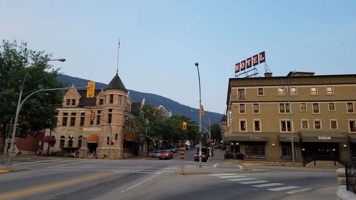
Ice Age Floods National Geologic Trail Total Affiliated Areas This Year: 19 Total Units: 29 North to CanadaWe continued our adventurous summer with a brief honeymoon in British Columbia, Canada. I planned us a road trip based around completing the International Selkirk Loop Scenic Drive. This route takes you through Washington, Idaho, and British Columbia. We spent the bulk of our time in Nelson, BC, a small historic city with an artsy international vibe. We stayed at a nice hotel on Kootenay Lake and sampled the different breweries in Nelson. We spent a day at the Ainsworth Hot Springs, about an hour north of Nelson. The hot springs are well worth a visit if you are ever in the area. They have a hotel, which we did not stay at, and a hot springs pool overlooking the lake. The hot springs also feature a cool cave in which you can experience the springs in their natural environment. After our stay in Nelson, we completed the Selkirk Loop and spent a day driving along Kootenay Lake. The highway requires passage on a ferry across the lake, which was a fun way to spend an afternoon. We made our way down the Selkirk Loop until we finished the loop, then headed south into Sandpoint, ID. This small lake town has become a tourist destination over the years and features a vibrant downtown. My mom grew up in Sandpoint and I spent many summers as a child in the town and on the lake here. We stopped for a quick drink at a local brewery and then headed back to Spokane. |
NPS Units:
|


 RSS Feed
